Chenango County, NY
-
Chenango County Poverty Facts
Unemployment rates are consistently higher than the general New York State rate. 1
More that 1,600 jobs have been lost in the county since 2000. 2
Median incomes are nearly $10,000 lower than the statewide average and are growing slower than the statewide average. 3
Approximately 1 in 5 of Chenango County's children live at or below the national poverty level. 4
Approximately 1 in 7 of Chenango County's overall population live at or below the national poverty level. 5
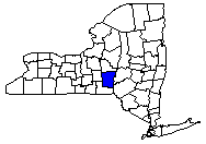
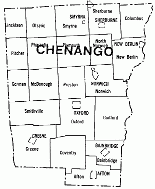
Chenango County is located in the Southern Tier of New York State, southeast of the center of the State. It is bounded on the North by Madison County, on the East by Otsego and Delaware Counties, on the Southwest by Broome County, and on the West by Cortland County. From the seat of the County government in Norwich, Chenango County is 90 miles from the New York State capital, Albany, and 150 miles from New York City. The County is 42 miles from Utica, 50 miles from Syracuse, 115 miles from Rochester, and 170 miles from Buffalo. The closest major population centers are Oneonta and Binghamton, which are 24 miles and 32 miles away, respectively.
With a land area of 894.42 square miles, Chenango County has a rural landscape full of rolling hills and beautiful valleys. Four rivers run through the County, the Susquehanna, the Chenango, the Unadilla, and the Otselic. Wildlife and waterfowl are found on the banks of these rivers. Approximately 30% of the county’s land is devoted to agricultural use, while over 60% is forested. Only about 5% of the County’s total land area is developed in commercial, industrial or residential use. Approximately 112,000 acres or 20% of Chenango County’s land is State owned.
Chenango County is easily accessible to New York State’s major population centers with 307 miles of highway that networks with state and interstate highways. New York State Route 12 is a major north-south corridor that runs through Chenango County and connects it to Utica in the North and Binghamton in the South. NYS Route 12 provides easy access to the NYS Thruway, Interstates 81, 88, and 86, and State Route 20.
Chenango County has access to air transportation through the Lt. Warren Eaton Airport in Norwich. The airport provides full charter services, full service maintenance, and aviation fuel sales. The County is within an hour’s drive from larger airports such as the Binghamton Regional Airport, the Oneida City Airport in Utica, the Hancock International Airport in Syracuse and 1.5 hours from the Albany International Airport.
While the county is not connected by commuter rail transportation, the NY Susquehanna and Western Railroad and the Delaware Railway serve Chenango County’s freight and transportation needs.
Public bus transportation is available in Chenango County through Coach USA. Buses run daily from Binghamton to Utica on Route 12. The county is also accessible through the Greyhound Bus Lines. Areas that do not have fixed route stops could be reached through DIAL-A-RIDE and private taxi and limousine services.